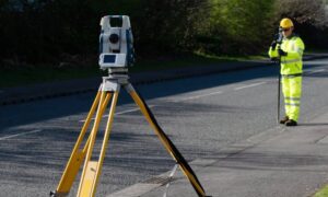
If you plan to build near the North Central West Virginia Airport in Bridgeport, one professional has to be on your team from day one: a construction surveyor. This isn’t just about staking corners or marking where a building goes. At airports, surveyors keep projects in line with strict Federal Aviation Administration (FAA) rules known as Part 77. These rules control heights, clearances, and “imaginary surfaces” that protect air traffic. Miss one detail and your crane, light pole, or roofline could stop a project cold.
Earlier this month, local news confirmed that a new aircraft and engine facility is breaking ground at the Bridgeport airport. With that construction, more warehouses, hangars, and access roads are expected to follow. Every one of those projects will need precise measurements and filings before crews even set up equipment. That’s where the right surveyor comes in.
What Makes FAA Part 77 So Important?
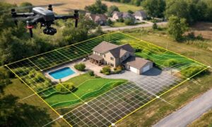
To most people, the sky above an airport looks wide open. Engineers and pilots see something different: invisible shapes that aircraft must pass through safely. These shapes, called imaginary surfaces, extend out from every runway. They slope upward at fixed angles and heights, guarding approach and departure paths.
If a structure rises too high inside those spaces, it can create a hazard. That includes cranes during construction, new hangars, light towers, and even antennas. Part 77 defines exactly where those surfaces start and how tall something can be before it becomes a problem.
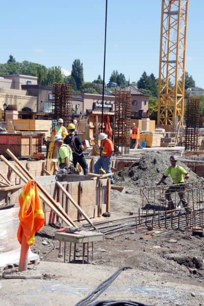
For Bridgeport, this matters because many development sites sit close to flight paths. A single crane can pierce those surfaces, even if the finished building won’t. Without careful measurements, a project could get delayed for months while waiting for FAA approval.
The Construction Surveyor’s Role on Airport Projects
So what do construction surveyors actually do in this environment? It’s more than most builders realize.
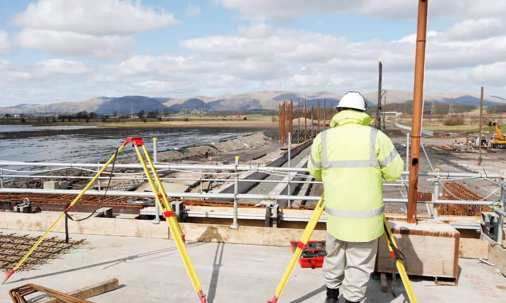
- Measuring control points and datums: Everything near an airport has to be tied to official vertical datums, not just local benchmarks. Surveyors set up the control that keeps all project elevations consistent with FAA standards.
- Calculating crane tip heights: Before a crane goes up, the surveyor checks its maximum reach in feet above mean sea level. This figure is critical for FAA Form 7460-1, the filing every project must submit when equipment or structures exceed limits.
- Performing obstruction surveys: The surveyor documents exactly where temporary and permanent features stand in relation to Part 77 surfaces.
- Delivering Exhibit “A” maps: FAA filings require precise site coordinates and elevation data. Surveyors prepare these exhibits so paperwork doesn’t bounce back.
- Checking as-builts: Once construction wraps, the surveyor confirms final elevations and certifies that no new hazards exist.
In short, surveyors aren’t just drawing lines on the ground. They’re the link between the project team and federal regulators.
When FAA Filings Are Triggered
Not every airport-area project needs FAA involvement, but many do. Here are the main triggers:
- Any structure taller than 200 feet above ground level, no matter where it is.
- Any project on or near airport property.
- Any crane, tower, or building that could rise into an approach or transitional surface.
For these cases, developers must file FAA Form 7460-1 through the OE/AAA online portal. The FAA recommends submitting at least 45 days before construction. Without survey data, it’s nearly impossible to complete this form correctly.
That’s why smart contractors bring in a surveyor early. Waiting until the crane is scheduled is a recipe for delay.
Local Impact: Bridgeport and Beyond
The CKB expansion is only the beginning. Once the new facility goes up, more development will likely follow. That includes service roads, new hangars, distribution centers, and possibly hotels. Each of these projects comes with the same risk: accidentally violating Part 77 surfaces.
And it’s not just on-airport work. Even subdivisions or commercial pads built a few miles out can still be affected. If your project falls under an approach path, the FAA could get involved. A surveyor familiar with both local conditions and federal rules becomes a safeguard.
For Bridgeport, that means developers and contractors must think ahead. Hiring a construction surveyor isn’t a nice-to-have; it’s a requirement for keeping projects on schedule.
The Cost of Getting It Wrong
Ignoring Part 77 or trying to cut corners with elevation data can create big problems. Picture a crane standing tall during steel erection. If the FAA hasn’t cleared its tip height, the agency can halt work immediately. That delay costs thousands in lost time and equipment rental.
Even worse, imagine finishing a structure only to find it violates the clearance zone. The FAA can order modifications or even removal. Those risks make survey fees look small compared to potential losses.
Clients don’t always see these dangers until it’s too late. That’s why contractors who explain the survey process early gain trust.
A Contractor’s Takeaway: Don’t Skip the Surveyor
If you’re a builder or developer, here’s the simple truth: your project near CKB will need FAA attention. You can’t file the right forms or set cranes safely without accurate survey data. A construction surveyor is the professional who makes sure your numbers add up.
That’s not just about compliance. It’s about keeping crews working, schedules moving, and investors confident. In today’s tight construction environment, one regulatory misstep can sink a project.
Final Thoughts
The new aircraft and engine facility at the Bridgeport airport marks a major step for the region. It also shines a spotlight on how much airport-area development depends on survey precision. The invisible lines of FAA Part 77 can’t be ignored, and only a skilled construction surveyor can guide projects through them.
So before you rent the crane, pour the footing, or file the permit, make sure the surveyor is on site. They’re not just marking ground — they’re keeping your project in the air, legally and safely.