Technology keeps changing how people understand land. Recently, cities and counties started using lidar mapping to make very detailed maps of neighborhoods and large areas. This technology collects millions of measurements from the ground. Because of this, planners and engineers can see land features much more clearly.
Most news stories talk about big cities. However, this change also matters for smaller places. Property owners may also see the effects of better mapping and land data. As mapping tools improve, land records and building plans may change. Because of this, learning how lidar mapping works can help landowners make better choices about their property.
Why LiDAR Mapping Is Getting So Much Attention
Many governments now use lidar mapping to update property data and improve city planning. Instead of using only simple aerial photos, this technology measures land with laser signals that scan the ground.
As a result, planners can create digital maps that show land shape, buildings, and other land features.
Because of this tool, cities can study slopes, drainage paths, and land changes across a community. These maps often show more detail than older maps.
For homeowners and landowners, this extra detail can matter. Better maps help cities plan roads, utilities, and new development.
How LiDAR Mapping Sees the Land Differently
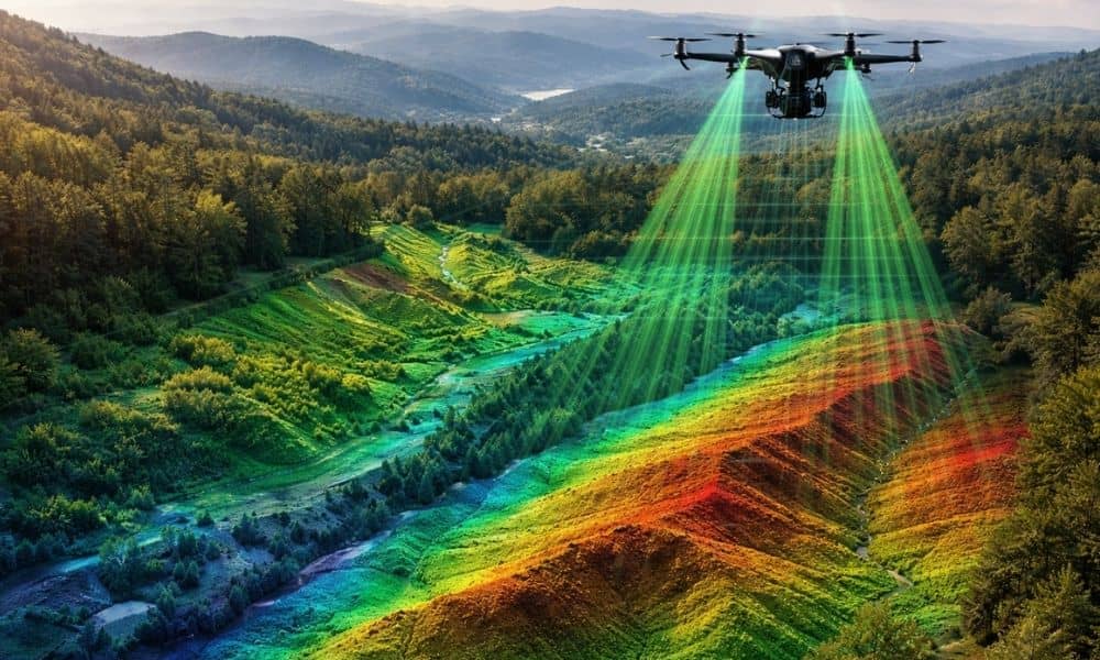
Regular aerial photos show what land looks like from above. However, lidar mapping measures the land itself.
The system sends many laser pulses to the ground. Then it measures how long they take to return. Software turns these measurements into a digital model of the land.
This process happens very fast. Because of this, lidar mapping collects many data points in a short time.
These points show small changes in elevation. They can show slopes, drainage paths, and dips in the ground that older maps may miss.
Even wooded land can be studied more clearly. Some laser pulses pass through gaps in trees and reach the ground. Because of this, lidar mapping often shows the real land surface.
This type of mapping helps in places like north-central West Virginia, where hills and trees are common.
What LiDAR Mapping Could Mean for Landowners
At first, lidar mapping may sound like something only engineers use. However, it can affect everyday property decisions.
Detailed land data helps professionals study land before construction begins. Builders and engineers can see slopes, drainage paths, and ground conditions early. Because of this, projects often avoid surprises.
People who want to develop land may also benefit from better mapping data. Engineers study the terrain before building homes, roads, or commercial sites.
Homeowners can also use this information. When people plan driveways, additions, or yard work, knowing the shape of the land can help prevent water problems later.
In simple terms, lidar mapping helps people understand their land before making big changes.
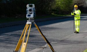
How Survey Professionals Use LiDAR Data
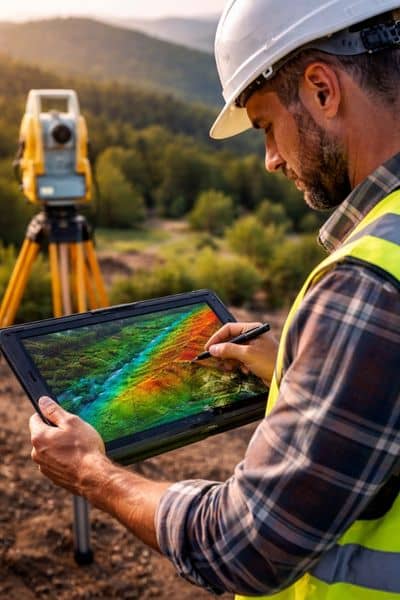
Even with modern technology, lidar mapping does not replace land surveying. A licensed surveyor still measures land to confirm legal property lines.
However, mapping data helps survey professionals prepare for their work. Surveyors can study terrain models before visiting a property. This helps them understand the land shape and key features.
Because of this preparation, survey crews can work more efficiently on site.
In many cases, lidar data and field measurements work together to create accurate land information.
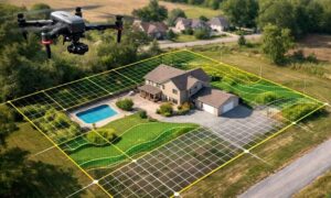
The Growing Role of Drones in Land Mapping
Another change in the industry involves aerial data collection. Survey professionals often combine lidar mapping with drones to gather land data from above.
Drones can fly across large areas and collect information quickly. Because of this, professionals can study large properties faster.
This method works well for wooded land, uneven terrain, and large development sites.
Instead of walking across rough ground, mapping equipment gathers data from the air.
Because of this, drones and lidar technology often work together to create detailed land models.
Why Accurate Land Data Matters More Than Ever
Many property owners think maps already show everything about their land. However, older maps often miss important details.
New mapping tools can show land features that older maps could not show.
Better land data can help prevent common property problems. For example, knowing slopes and drainage can help builders avoid water issues.
Land data also matters when people buy or sell property. Buyers, sellers, and developers need good information when studying land.
Because of this, better mapping helps reduce risk when making property decisions.
The Human Expertise Behind Modern Mapping
Even with advanced technology, people still play an important role. Engineers and survey professionals study mapping data and turn it into useful information.
A licensed surveyor confirms legal property boundaries using professional tools and field measurements.
Mapping technology can support that work. However, trained professionals still make the final decisions.
Because of this teamwork between technology and experience, modern land analysis can provide clear and reliable results.
Looking Ahead for Property Owners
Mapping technology will continue to improve in the future. The rise of lidar mapping shows how quickly land mapping tools are changing.
For landowners, this change means better information when planning construction or property improvements.
Terrain data can show possible issues early. Because of this, property owners can make smarter choices.
Even as technology improves, professional surveying will still matter.
In the end, lidar mapping helps professionals and landowners understand the land more clearly.