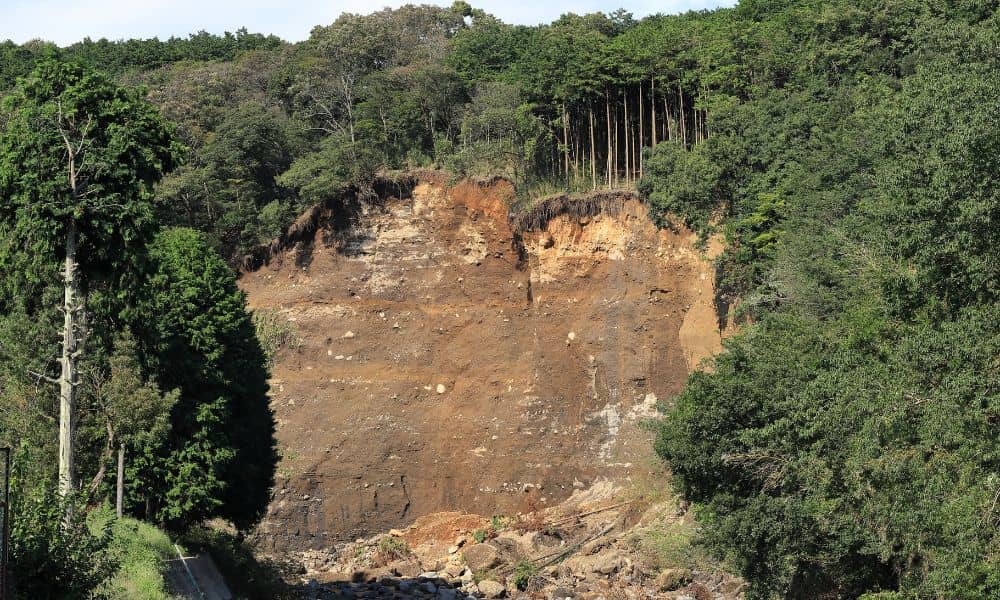
A few days ago, a landslide video from Italy went viral. Heavy rain hit a quiet hillside town, and within seconds, the ground gave way. A home collapsed and slid downhill like it was made of paper. People all over the world watched the clip in shock. As heartbreaking as it was, it also sparked a real question here at home: could something like this happen in West Virginia—and can tools like drone surveying help us spot danger before it strikes?
The truth is that landslides don’t just happen in far-away places. They happen anywhere the ground becomes unstable, and North-Central West Virginia has plenty of slopes, valleys, and waterways that can shift after long rainstorms. In fact, Bridgeport and the surrounding communities have dealt with their share of sinkholes, drainage problems, washed-out roads, and failing embankments. Because the terrain looks peaceful most days, homeowners don’t always think about what’s going on under the surface—or how quickly the ground can change.
However, the Italy video gave us a rare chance to see what a failure looks like in real time. It also pushed the spotlight onto an important idea: using drone surveying to understand slopes, water flow, and early warning signs that you can’t easily see from the ground.
Why Ground Instability Happens More Often Than Most People Think
Most people picture a landslide as a random disaster, but it isn’t random at all. It builds up quietly over time. When the soil becomes soaked, heavy, or loose, it can eventually reach a breaking point. Add steep hills, aging drainage systems, and repeated storms, and the risk grows fast.
In West Virginia, ground movement happens for a few key reasons:
- Hillsides are naturally steep in many neighborhoods.
- Our soil stays wet longer after storms.
- Water cuts small channels into the ground over time.
- Old embankments weaken after years of pressure.
- Some properties sit near old underground voids or disturbed soil.
Because these problems often start small—like a tiny crack in the yard or a soggy patch near a ditch—many homeowners don’t notice them until something bigger happens.
That’s where drone surveying comes in. It shows the “bigger picture” of a property, even when the ground looks fine from the driveway.
How Drone Surveying Helps Reveal Hidden Risks
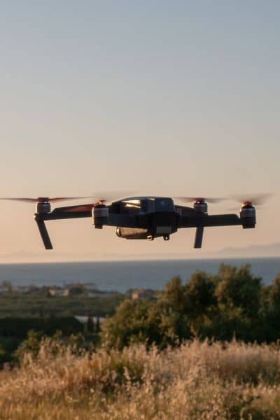
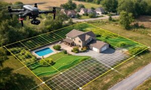
Drone surveying is one of the most useful tools for seeing how land is changing. Instead of relying only on what you can see on foot, a drone gives a bird’s-eye view of your entire property, including the steep slopes, drainage paths, and wooded areas you might never walk through.
And because drones capture detailed elevation data, they can reveal patterns that point to early instability.
For example, drones can show:
- Slopes that are steeper than they look from the ground.
- Areas where water is carving channels through the soil.
- Spots where the ground has started to sag or separate.
- Banks near creeks or culverts that look undercut.
- Bare patches of soil where erosion has already begun.
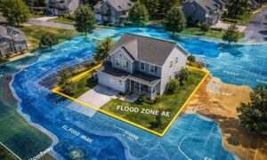
From the air, these clues form a clear picture. Even better, the drone’s data gets turned into 3D maps and elevation models that show how the land shifts, where water travels, and which parts of the property need attention before building or buying. This doesn’t mean drone surveying can predict the exact moment a hillside will collapse. But it can highlight weak spots long before the failure starts. That’s the kind of early information that gives homeowners, buyers, and builders time to act.
Why Bridgeport Needs to Pay Attention After the Viral Video
Bridgeport is surrounded by rolling hills and neighborhoods built on cut-and-fill slopes. Some homes sit below steep wooded banks. Others overlook valleys with natural drainage lines. When rain falls often—as it does in West Virginia—water moves through these slopes in ways that homeowners usually never see.
Recently, areas around Bridgeport have dealt with:
- Sinkholes forming after heavy storms.
- Roads settling or cracking due to water underneath.
- Embankments needed repair because soil slipped.
- Drainage systems failing and causing soft spots in yards.
These issues don’t make Bridgeport unsafe, but they do mean that buyers and homeowners should understand the land before making big decisions. And since the Italy landslide shook people worldwide, it reminded many of us that nature gives very little warning.
Because of this, drone surveying has become a smart step for anyone thinking of building on a slope, buying a hillside lot, or solving a drainage problem.
What Drone Surveying Can Show a Homeowner That a Walk-Through Can’t
Imagine standing in your backyard. Everything looks calm. The slope behind the house seems sturdy. The creek looks harmless. But once a drone flies over, the story can change.
You might see:
- A long erosion path where rainwater has been racing downhill.
- A dip in the ground that could turn into a sinkhole after a storm.
- Soil pulling away from the top of a hill.
- A slope angle that’s sharper than you thought.
- Water pooling in hidden spots that weaken the soil.
These are early warnings—small signs of shifting land that a simple walk-through won’t reveal. When a surveyor studies the drone data, they can point out where you may need better drainage, soil reinforcement, or a change to your building plan.
For buyers, this information can prevent you from choosing a lot that looks nice but will need thousands of dollars in slope work later. For homeowners, it can stop a small problem from turning into a major one.
So… Can Drone Surveying Predict a Landslide?
Here’s the honest answer: Drone surveying can’t say, “A landslide will happen on Tuesday at 3 PM.”
But it can show the warning signs that lead to slides, soil slips, and slope failures.
It helps identify:
- Unstable slopes
- Erosion
- Soil movement
- Hidden water flow
- Low spots starting to collapse
- Places where the land has shifted after storms
When surveyors and engineers study these patterns, they can tell you how serious the risk is and what to fix before something happens.
So while drone surveying doesn’t “predict” a disaster, it gives you the tools to understand your land and make safer choices.
A Smart Move for Buyers and Homeowners
If you live in Bridgeport, Clarksburg, Shinnston, or any hillside community in our region, the viral landslide video is more than just shocking—it’s a reminder of how important it is to understand the land you live on.
Drone surveying gives you a clear picture of your property’s slopes, drainage, and risks. It helps you make decisions with confidence, whether you’re buying a new lot, planning a build, or checking your land after heavy storms.
In a place with as many hills as North-Central West Virginia, having accurate aerial data isn’t just helpful—it’s smart.
So before you build, buy, or start a major project, consider getting a drone survey. It’s one of the best ways to protect your home, your land, and your peace of mind.