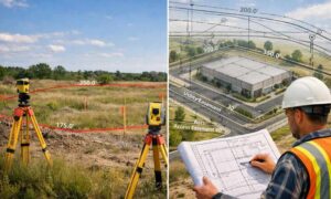
A lot of site plans look good on paper. The layout makes sense. The buildings fit. The parking lines up.
Then the city reviews it, and suddenly there are comments, revisions, and delays.
That usually happens because something on the site was not fully checked before submission. Not the design, but the actual ground conditions and property details.
This is where surveying companies come in. They help catch problems early, before plans go to the city.
Why Site Plans Get Sent Back
City reviewers don’t focus on style or design ideas. They look at accuracy.
If the numbers don’t match real conditions, the plan won’t pass. If something is missing, it gets flagged.
Common issues include:
- Property lines that don’t match records
- Buildings placed too close to boundaries
- Access points that don’t meet city rules
- Hidden restrictions on the land
These problems don’t show up during drafting. They show up when someone checks the site itself.
Checking the Property Lines First
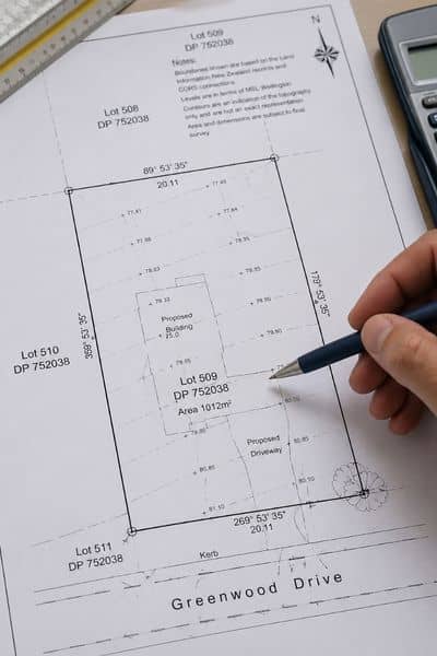
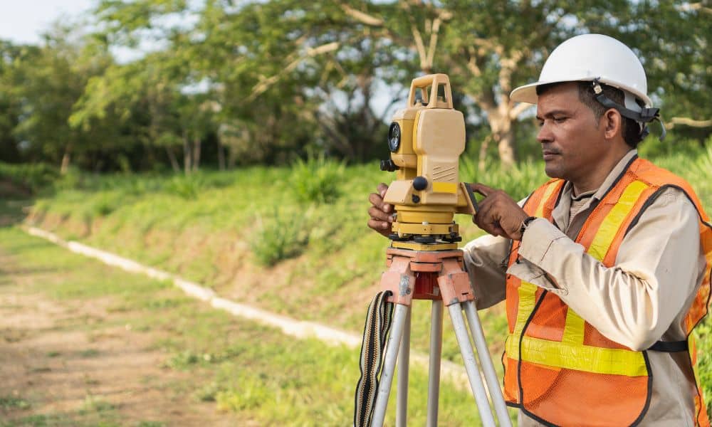
Surveying companies start with the basics. They confirm where the property begins and ends.
That sounds simple, but it often isn’t.
Old records can be off. Fences don’t always sit on the true line. Some corners may not even be marked clearly anymore.
So they measure the land and compare it to legal records. Then they mark the correct boundaries.
This matters because every part of the plan depends on it. If the property lines are wrong, everything else shifts too.
Making Sure Setbacks Are Correct
Cities require space between structures and property lines. These are called setbacks.
Designers usually follow setback rules. Still, problems happen when those measurements rely on incorrect base data.
Surveying companies check the real distances on site. They make sure buildings, parking, and other features stay within allowed limits.
Even a small error can cause a plan to come back for revision.
Finding Encroachments Early
Not everything on a property belongs there.
A fence might cross into a neighbor’s land. A driveway could sit partly outside the boundary. A shed might be too close to the line.
These are called encroachments.
They often go unnoticed until a survey is done. If they show up after submission, they can slow things down.
Surveying companies identify these issues early. That gives owners time to adjust the plan or fix the problem.
Identifying Easements That Limit Use
Some parts of a property cannot be built on.
These areas may be set aside for utilities, drainage, or shared access. They are called easements.
They don’t always stand out. In many cases, the land looks usable, but it has legal limits.
Surveying companies review records and field data to locate these areas. Then they show exactly where building is allowed and where it is not.
Missing this step can stop a project before it even begins.
Checking Access and Road Connections
Cities care a lot about how a property connects to the road.
Driveways need proper spacing. Entry points must meet safety rules. Some sites require specific widths or turning space.
Surveying companies verify how the property meets the road. They check alignment with public areas and confirm that access points follow local rules.
If access is off, the plan will need changes.
Looking at Utilities on the Surface
Utility lines can affect layout decisions.
Some are easy to see, like poles, boxes, or manholes. Others show signs on the surface.
Surveying companies map these visible features. Then they compare them with the planned layout.
If a building or driveway conflicts with a utility, the issue gets flagged early.
That saves time later when construction starts.
Reviewing Ground Elevation
Not all land is level.
Small changes in height can affect how a site plan works. Water flow, building placement, and drainage all depend on elevation.
Surveying companies measure these changes across the site. They give designers accurate information to work with.
Without that, plans may need updates after review.
What Happens When These Checks Are Skipped
Skipping these steps doesn’t save time. It usually creates more work.
Plans get sent back. Revisions take time. Teams go back and forth to fix issues that could have been caught earlier.
That affects timelines. It also adds cost.
In some cases, projects stall because the site conditions don’t match the plan at all.
Why Developers Involve Surveying Companies Early
More projects are going through detailed review now, especially in growing areas.
Cities expect accurate data from the start. They don’t want to guess what the site looks like.
Because of that, developers bring in surveying companies earlier in the process.
Instead of fixing problems after submission, they prevent them before the plan is sent in.
When to Call Surveying Companies
Timing matters.
It’s best to bring in a surveying company before the design is final. That way, the layout is based on real data, not guesswork.
If you’re getting close to submitting plans, this is also the stage where surveying companies help make sure everything is ready for site plan approval. A final check can catch small issues that are easy to miss.
If you wait until comments come back, you’re already behind, and fixing those problems takes more time.
Getting Plans Ready the First Time
A site plan can look complete and still miss key details.
Most delays don’t come from bad design. They come from missing or incorrect site information.
Surveying companies focus on that layer. They check what’s actually on the ground and how it lines up with the plan.
When that part is solid, the review process moves smoother.