Land development is changing as new tools make it easier to understand complex terrain. Remote sensing technology is now one of the most important tools in modern surveying. In areas like Bridgeport, WV, where land conditions can vary, having accurate data early makes a big difference.
Why Remote Sensing Technology Is Becoming More Common
The closest recent trend is the growing use of remote sensing technology in infrastructure and environmental projects across the U.S. Agencies and developers are using advanced tools to study terrain, drainage, and land stability.
This shift is happening because traditional methods can take more time and may miss small but important details. Tools like lidar mapping allow survey teams to collect detailed data faster and with greater accuracy.
How Remote Sensing Technology Improves Land Data Accuracy
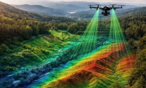
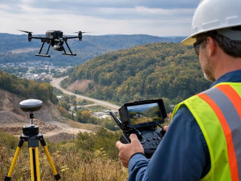
Remote sensing technology collects data without direct contact with the land. One of the most common methods is lidar mapping, which uses laser-based measurements to capture surface details.
This process creates a detailed model of the terrain. It helps surveyors see elevation changes, slopes, and surface features that are not always visible during a site visit. That level of detail supports better planning with accurate site data, especially when early project decisions depend on reliable information.
Why This Matters in Areas Like Bridgeport
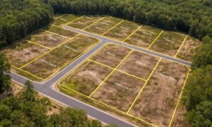
Bridgeport and nearby areas often include uneven terrain, wooded land, and changing elevations. These conditions can make planning more difficult without reliable data.
Using remote sensing technology helps reduce uncertainty. It gives a clearer view of the site before decisions are made, especially for development and land planning.
Getting a smarter approach to planning your site data allows teams to work with better information from the start instead of fixing problems later.
Common Challenges Remote Sensing Technology Helps Solve
Many project delays come from missing or incomplete site data. Remote sensing technology helps reduce these issues by improving accuracy and coverage.
Some common challenges include:
- uneven terrain that affects construction plans
- hidden elevation changes
- drainage patterns that are not easy to see
- areas that require grading or adjustment
These issues can slow down projects if they are discovered too late.
How Better Data Leads to Better Project Decisions
Accurate data leads to better decisions. When teams understand the site early, they can plan more efficiently and avoid costly changes.
Remote sensing technology supports faster workflows and fewer surprises. It does not replace professional expertise, but it gives surveyors stronger data to work with.
In a place like Bridgeport, that early clarity can make a major difference in how a project moves forward.