West Virginia’s new Jobs First — Opportunity Everywhere plan is big news. The state wants to grow the economy, create more jobs, and help local businesses. As this plan moves forward, Bridgeport will see more building activity. And with every new project, a construction survey becomes one of the first and most important steps. This change will shape how fast homes, offices, and public projects get built in the next few years.
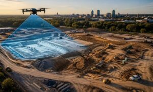
Bridgeport already grows faster than many nearby towns, but the Jobs First plan speeds things up even more. With new incentives and more money for public infrastructure, the area will see more job sites starting at the same time. Roads, utilities, neighborhoods, and business parks all need accurate layout before any digging or building begins. Survey crews mark the ground so builders know exactly where each part of the project belongs.
How the Jobs First Plan Pushes Development Forward
The Jobs First plan focuses on supporting business growth and helping more people join skilled trades. This makes a big difference. With more training programs and apprenticeships, more workers will enter the construction field. When more crews start new projects, the demand for survey layout rises quickly. No one can pour a foundation or set a utility trench until the site is marked.
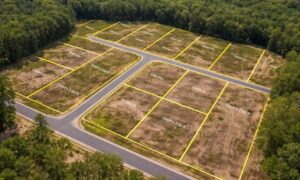
One of the strongest effects will be seen in fast-growing areas like Bridgeport. Places such as Charles Pointe and White Oaks are already busy development spots. With new state incentives, even more companies may decide to build here. That means more buildings, more road work, and more utility installations. Every one of those needs a survey team to set the layout before work begins.
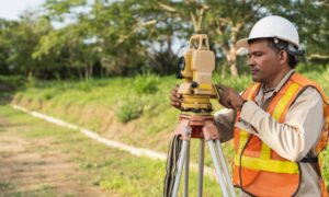
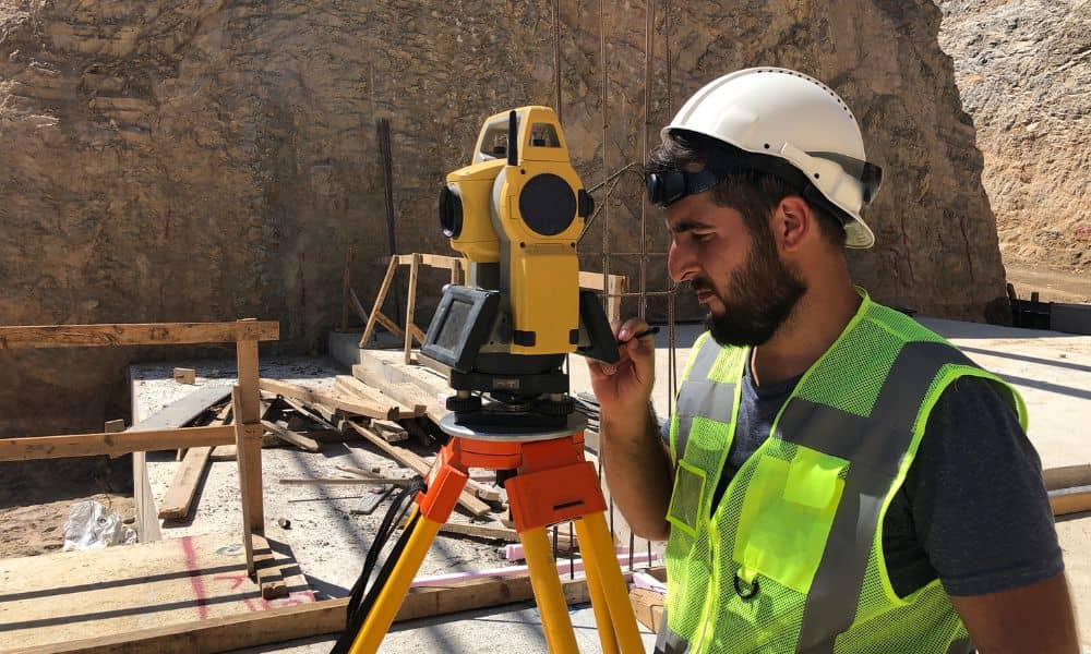
Why Construction Surveys Become Even More Important
Construction surveys help keep projects on schedule. When the construction industry gets busy, timing becomes even more important. Crews depend on layout before they can begin any physical work. Surveyors mark corners, building lines, grades, and elevations. Without those marks, nothing can move forward.
As demand rises, survey teams will have fuller schedules. What used to be a short wait might become a longer one. A garage project, a home addition, or a new driveway can all be delayed if the survey isn’t done in time. For bigger commercial projects, delays can affect inspections, deliveries, and subcontractor schedules.
This is why construction surveys matter so much during growth periods. Even small projects rely on accurate layout, and busy seasons leave little room for errors or slowdowns. Builders who plan ahead and book early keep their projects moving smoothly. Homeowners who prepare early avoid delays that can push their plans back by weeks.
How Bridgeport Could Be Impacted First
Bridgeport often feels statewide changes before other towns. It sits in a central location with strong job markets nearby. Families and businesses choose this area because it has good schools, easy access to highways, and active development zones.
When the state invests in roads, utilities, and public buildings, surveyors become even more important. These projects require precise staking and elevation checks. They often take more time than small residential jobs. When public projects and private construction overlap, survey teams get busier, and wait times grow.
Because Bridgeport has tight neighborhoods and land that slopes in many areas, clear layout becomes even more important. Builders rely on accurate points to avoid drainage issues, setback problems, and spacing errors.
What Builders and Homeowners Should Expect
As construction increases, builders and homeowners should expect longer scheduling times. Surveyors may book out several weeks, especially during busy seasons. Planning early becomes part of the building process. Even simple projects like sheds, porches, or additions need survey layout before work begins.
Bundling survey services may also help. When a project includes a topographic survey, a site layout, and an as-built check, doing them with the same team saves time. It also helps keep the project flowing from start to finish.
A construction survey sets the stage for everything else. With growth spreading across Bridgeport, this first step matters more than ever.
Looking Ahead: A Busier Future for Bridgeport
The Jobs First plan brings new energy to West Virginia. As the state pushes for more development, Bridgeport will feel the changes early. More crews, more projects, and more investment mean more survey work across the region.
Construction surveys make sure every project starts in the right place. They support safety, accuracy, and smooth progress. With the growth ahead, they will play an even bigger role in shaping homes, roads, and businesses in Bridgeport.