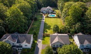
How Land Surveying Helps Check Access for Flag Lots
A back lot in Bridgeport can look like a smart buy. It sits away from the road, feels quiet, and often costs less than nearby
Why Remote Sensing Technology Matters More Today
Land development is changing as new tools make it easier to understand complex terrain. Remote sensing technology is now one of the most important tools
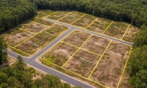
A Lot Survey Can Prevent Final Plat Delays
You’ve got land. You’ve planned out your lots, and everything looks right on paper. So you move forward, expecting a smooth approval. Then the city

Can a FEMA Elevation Certificate Lower Insurance Costs?
If you live in Bridgeport, WV, you may have seen your flood insurance cost go up. It can feel confusing and unfair. You might wonder,

How LiDAR Mapping Is Changing Property Data
Technology keeps changing how people understand land. Recently, cities and counties started using lidar mapping to make very detailed maps of neighborhoods and large areas.

How a Boundary Survey Prevents Property Line Disputes
Property lines may look simple on paper. However, in real life, they often cause tension between neighbors. A fence gets built. A shed appears near