Bridgeport’s downtown has been buzzing this week after city leaders approved a major Main Street property purchase. Deals like that spark big questions fast: What will they build? How soon will it happen? What will it cost? However, one quiet step protects any land deal—whether it’s a city project or your personal investment. That step is a due diligence survey, and it can save you from surprises that show up after closing.
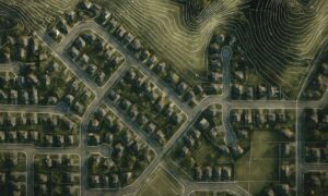
Downtown land looks simple because you can see the lot from the sidewalk. Yet older parcels come with older records, shared access points, and utility routes that don’t show up on a walk-through. So if you want your project to move forward with fewer delays, you need to confirm what the paperwork says and what the ground shows.
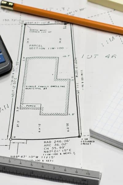
What a due diligence survey really means
A due diligence survey is “trust, but verify” for property. You don’t just ask, “Where are the lines?” You also ask, “What limits this land?” and “Do the records match real conditions?”
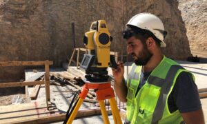
A surveyor reviews deeds, plats, and recorded easements, then checks the site for evidence like monuments, fences, walls, and long-standing improvements. Next, they create a clear drawing and notes you can use to plan, negotiate, and design. In short, the due diligence survey turns a risky guess into a grounded decision.
Why Bridgeport-style downtown deals come with extra risk
Downtown areas have history. That history shows up in tight lots, older buildings close to lines, and changes people added over decades. Meanwhile, past owners may share driveways, use alleys, or extend pavement without thinking about future sales. Because of that, a buyer can “own” a parcel and still face limits that shrink what they can build.
That’s why the recent Main Street purchase feels like a lesson for everyday buyers. The city can work through surprises over time. Most people can’t. So you want clarity early.
The hidden problems that can blow up a budget
Boundary confusion that forces redesigns. Many buyers assume a fence or curb marks the property line. But fences move, and curbs don’t define ownership. Also, older descriptions can conflict. If you design first and verify later, you risk moving a building, a driveway, or even a parking layout. A due diligence survey ties the record description to real points on the ground, so your plans fit the land you actually own.
Easements that block your best idea. An easement gives someone else a right to use part of your property. Utilities, access rights, and drainage easements show up often in town areas. Unfortunately, they tend to cut through the most useful space—the spot you wanted for parking, a building corner, or a sign. When you uncover easements early, you can adjust the design or negotiate before you commit money.
Encroachments that trigger neighbor drama. An encroachment happens when something crosses a boundary—steps, walls, fences, sheds, or paved areas. Downtown parcels raise the stakes because everything sits closer together. Encroachments can also scare lenders and delay title work. However, when you see them during due diligence, you still have choices. You can negotiate a fix, revise your layout, or walk away.
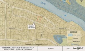
Drainage and elevation issues that don’t look obvious. Water always finds a path. A site can look flat and still collect runoff in the wrong spot. In addition, older paved areas and curb lines can push water across property lines. If flood-related rules apply, elevations matter even more. So you want to know early whether the site needs grading changes, added drainage, or extra design steps to avoid permit delays.
Utility conflicts that show up when you dig. This problem hits late and costs a lot. You can plan a foundation, then discover a buried line in the way. Downtown corridors often have more utilities, and records don’t always match reality. A due diligence survey won’t locate every buried line, but it helps you spot likely corridors and coordinate next steps, like utility locating, before excavation.
A quick warning about online parcel maps
Online parcel maps help you get oriented, but they don’t set legal lines. Use them for general reference, then rely on a licensed surveyor when boundaries affect money, permits, or neighbors.
How to make this practical for your own deal
You don’t need to buy a big downtown parcel to benefit from a due diligence survey. People run into the same issues when they buy a home with an old fence line, purchase a lot for a new build, add a driveway or garage near an edge, or split land with family. In each case, timing matters. If you wait until the last minute, you force rushed decisions. Meanwhile, when you start early, you gain leverage. You can negotiate repairs, adjust price, or redesign while the deal still has flexibility.
What to say when you call a surveyor
Most people ask, “How much?” first. Instead, lead with your goal. Try: “I’m buying property in Bridgeport. I want a due diligence survey to confirm boundaries, easements, and conflicts before closing. What do you need from me, and what will I receive?”
That one sentence saves time because it tells the surveyor what outcome you want. Also, gather basics before you call: the address, parcel or tax ID if you have it, the deed reference if available, and any old plat from the seller. Then the surveyor can start faster, and you can get a cleaner timeline.
The bottom line:
Bridgeport’s downtown deal shows how quickly land plans can move from idea to action. However, land doesn’t care about timelines. It holds easements, drainage patterns, and boundary history whether you know them or not. So treat the due diligence survey like smart insurance. It helps you avoid the delays and costs that show up later—after closing, after design starts, and after contractors wait for answers.
Start early, verify the facts, and move forward with confidence.