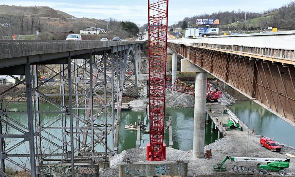
If you’ve driven through Bridgeport lately, you’ve probably noticed the cranes, concrete pillars, and partial roadways that seem to stretch on forever. The photo above shows the ongoing work on the I-79 bridge, a clear sign that this important highway is still under heavy construction. For many locals, the question on everyone’s mind is simple: Will I-79 ever be finished? Aerial survey teams are playing a crucial role in finally solving the long-standing highway headaches in Bridgeport.
Why Is I‑79 Always Under Construction?
First, let’s look at why this stretch of highway always seems torn up.
I‑79 is a major road connecting cities and moving goods through West Virginia. It runs right through Bridgeport and links to Morgantown, Clarksburg, and beyond. Because it’s so important, any time the road breaks down or shows signs of wear, it needs to be repaired quickly.
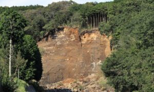
But West Virginia isn’t flat. The terrain is rough, with hills, valleys, and unstable soil in some places. Add in heavy rain, snow, and natural wear over time—and you’ve got a recipe for constant road damage.
Fixing these problems takes time. Before any construction even begins, engineers need to study the land, plan the layout, and make sure everything is safe. That’s where aerial surveys come in.
What Is an Aerial Survey, Anyway?
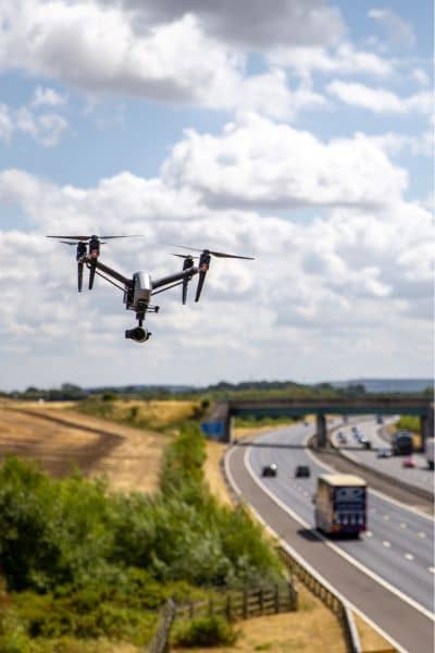
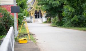
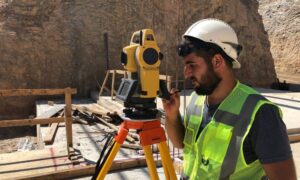
An aerial survey is when a team uses drones or planes to take detailed photos and scans of land from above. This allows engineers and planners to get a full view of the area without having to walk every inch of it.
Think of it like Google Maps, but way more accurate and up-to-date. These surveys can show tiny cracks in roads, changes in the land, and even hidden problems like erosion or flooding risks. The technology behind it uses things like LiDAR (which is like radar, but with lasers) to measure height and shape.
This is especially helpful in places like Bridgeport, where ground crews might have trouble getting to steep or overgrown areas.
How Do Aerial Surveys Help With I‑79?
When it comes to fixing I‑79, time is everything. Delays cost money and frustrate drivers. Traditional surveying methods—where crews go out with measuring tools—can take weeks. But with an aerial survey, the same job might take just a day or two.
Here’s how aerial survey teams help:
- Faster Data Collection: Drones can scan large areas quickly. This speeds up the planning phase.
- More Accurate Results: Aerial surveys give high-resolution images and data. This helps engineers catch problems early.
- Safer Conditions: Survey teams don’t need to work near traffic or dangerous areas. The drone does the risky part.
- Better Planning: With 3D models and topographic maps, planners can design smarter, more durable roads.
So while the road might still feel like a mess to drivers, there’s actually a lot happening in the background to make things better—and faster—thanks to these flying tools.
Is Aerial Surveying Really Being Used in Bridgeport?
Yes, absolutely. Aerial survey work is already being used in projects across the Bridgeport area. For example, the Thompson Drive slip repair project—one of the city’s ongoing infrastructure improvements—includes surveying work as a major step.
Companies like The Thrasher Group, who handle large-scale engineering projects in West Virginia, often use drones and other aerial tools to plan their work. Even if you don’t see a drone flying overhead, it’s likely that one helped prepare the blueprints for the repairs you’re driving past.
Why Homeowners and Builders Should Care
You might think aerial surveys only matter for highways and big construction sites. But that’s not true.
If you’re planning to buy land, build a new home, or even get a flood elevation certificate, an aerial survey could help you too. It can make a property line survey more accurate, speed up a construction staking survey, or help identify flood risks before you build.
Here’s how aerial surveys are useful for regular people:
- Buying or selling property: Get accurate land maps to avoid disputes.
- Homebuilding: Plan the layout and grading of your site.
- Flood zone insurance: Get faster, more reliable elevation survey data for your FEMA certificate.
- Land development: For subdivision surveys or land planning, drones speed everything up.
Basically, aerial surveys aren’t just for highways—they’re for anyone who wants a clear view of their land, faster and safer.
Bridgeport’s Future Is (Literally) Looking Up
Even though it feels like I‑79 is always under construction, things are moving forward. Thanks to the power of aerial surveying, road repairs can be planned smarter, done faster, and made safer for everyone involved.
So the next time you’re stuck in traffic on I‑79, frustrated and wondering what’s taking so long, remember: some of the work is happening above your head. Aerial survey teams are quietly helping to solve the problems you can’t even see—until the job is done.
Final Thoughts
Aerial surveys may not be the flashiest part of construction, but they’re one of the most powerful tools in modern land surveying. They cut down on delays, improve safety, and give decision-makers the data they need to do things right the first time.
Whether it’s a massive interstate repair or a backyard boundary survey, flying high gives us a better view of the future. And in Bridgeport, that’s something we can all look forward to.