If you live in Bridgeport, West Virginia, and your bank or insurance company just asked for an elevation certificate, you’re probably wondering what it is—and why it costs money. Before you order one, there’s a simple way to save time and possibly avoid extra fees. You can use the free WV Flood Tool, a state-run website that helps you see your property’s flood risk and location on FEMA maps. In just a few minutes, you can grab two screenshots that tell your surveyor almost everything they need to get started.
Why the WV Flood Tool Matters
An elevation certificate measures how high your home or building sits compared to the base flood elevation in your area. Insurance companies and lenders use it to decide flood insurance rates and loan eligibility.
Here’s the problem: many homeowners order one before even checking if they truly need it. The WV Flood Tool lets you see where your property sits within FEMA flood zones. That means you can find out if your home is actually in a floodplain, on the edge, or completely outside of it.
The tool is free, fast, and built by the state’s floodplain management office. It uses official FEMA data and local maps, so the information is reliable. With the right screenshots, you’ll make your surveyor’s job easier—and maybe even save money if a full elevation certificate turns out unnecessary.
Step 1: Open the WV Flood Tool
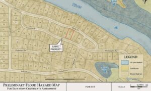
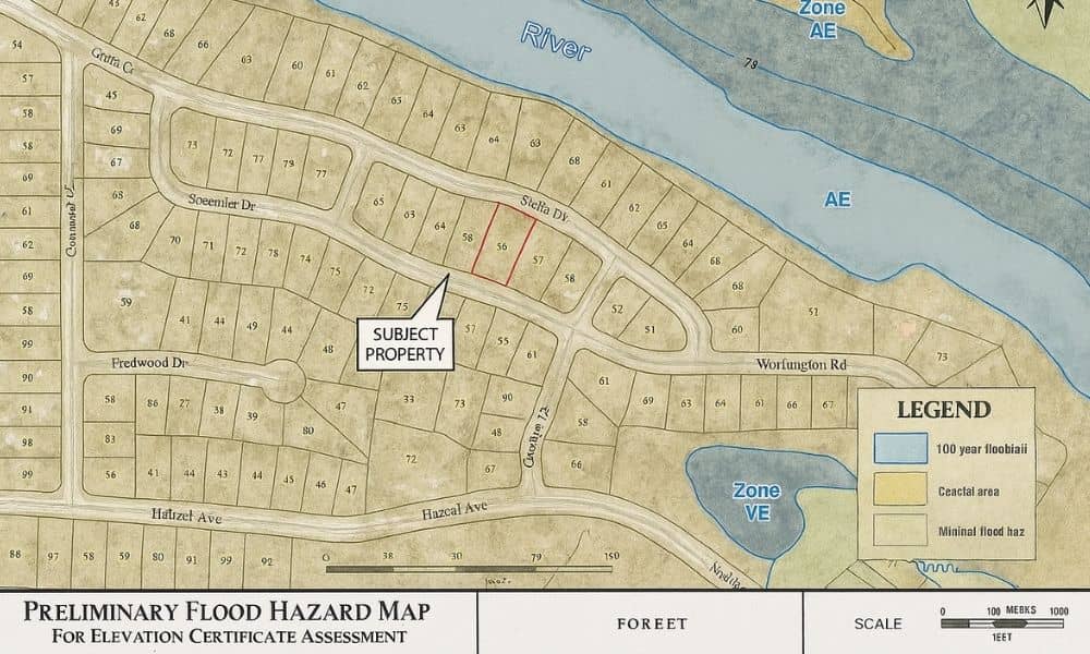
Start by visiting the WV Flood Tool website. You’ll see a map of the state with a search bar on the left. Click the “Public” view—it’s the easiest mode to use.
Type your property address into the search box. The map will zoom in to your neighborhood. You’ll notice color-coded areas: blue and orange zones mark different flood risk categories.
Here’s a quick tip: zoom in slowly so the layers load clearly. If your internet is slow, give it a few seconds. Once your parcel appears, you can turn on helpful layers like Stream Lines and Parcel Boundaries. These outlines make it easy to see exactly where your property sits in relation to nearby creeks or flood zones.
When you have the map showing your lot clearly, take Screenshot #1. This image should show:
- Your property boundary
- Nearby streams or rivers
- Any shaded flood zones that overlap your parcel
Save that image—it’s your first snapshot for your surveyor.
Step 2: Find Your FEMA Panel and Flood Zone
Next, look toward the bottom or right side of the map. You’ll see information about your FEMA panel number and flood zone. This data is essential for your elevation certificate.
Each zone code has a meaning:
- Zone AE or A – High flood risk; an elevation certificate is usually required.
- Zone X (shaded) – Moderate risk; certificate sometimes needed.
- Zone X (unshaded) – Minimal flood risk; often no certificate required.
Hover your mouse (or tap on mobile) over your property. A small info box should appear with your panel number, flood zone, and sometimes the base flood elevation (BFE).
Take Screenshot #2 of this view. Make sure the map shows both your parcel and the flood information box. This second image helps your surveyor confirm which FEMA map your property falls under.
Step 3: Decide if You Actually Need an Elevation Certificate
Now that you have your screenshots, you can make a smart decision. Not everyone needs an elevation certificate right away.
If you’re:
- Buying or refinancing a home and your lender specifically requests it → You’ll need a certified elevation certificate.
- Renewing flood insurance and your agent needs proof of elevation → You’ll likely need it, too.
- Just curious about your property’s flood status → Your screenshots might be enough for now.
Many residents discover they’re actually in Zone X, meaning a certificate isn’t required. But if your property touches or crosses into a high-risk area, ordering one early helps avoid closing delays.
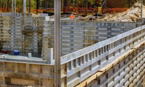
FEMA’s new insurance rating system means flood insurance pricing now depends more on actual property elevation and distance from water—not just which zone you’re in. That’s why your surveyor uses the elevation certificate to collect accurate elevation data from your foundation, floor, and surrounding grade.
Step 4: What to Send Your Surveyor
When you contact a licensed land surveyor, you’ll save time if you include these details:
- Property address and parcel ID (from your tax bill)
- Those two WV Flood Tool screenshots
- Notes about your home’s foundation type (basement, crawlspace, or slab)
- Any old elevation certificate you might already have
This information allows the surveyor to confirm which flood panel applies and how much fieldwork is needed. Many surveyors can give a more accurate quote if they can see your flood zone and nearby water features in advance.
Also note: FEMA updated the Elevation Certificate form recently. Old certificates might not meet current standards. That’s why surveyors always issue a fresh, signed copy with up-to-date elevation data.
Step 5: Bonus Tip for Builders and Developers
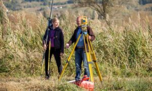
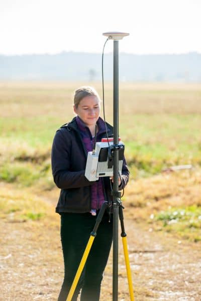
If you’re working on a construction project or subdivision, you can take it one step further. Use the West Virginia GIS Elevation Portal to explore elevation maps of your site.
LiDAR (Light Detection and Ranging) gives detailed topographic data, showing how the land slopes and where runoff naturally flows. It’s perfect for checking how your site sits compared to surrounding grades—especially if you plan to add fill, cut soil, or build near a stream.
Even if you’re not an engineer, sharing elevation screenshots with your surveyor can make the process smoother and help them prepare their equipment setup before arriving on-site.
Why This Step Saves You Stress
When homeowners skip this pre-check, they often face two problems:
- Survey delays because the field crew didn’t have enough information ahead of time.
- Surprise costs if the property isn’t in a flood zone but a certificate was ordered anyway.
By taking a few minutes to use the WV Flood Tool, you can avoid both. It’s a free, local resource that’s updated with FEMA data, so you’re not guessing. Plus, having those screenshots ready tells your surveyor you’ve already done your homework—something professionals appreciate.
Final Thoughts
Ordering an elevation certificate doesn’t have to be confusing or stressful. A little preparation makes the process simple. The WV Flood Tool helps you see your flood risk, confirm your FEMA panel, and gather what your surveyor needs—without leaving your couch.
So before you spend money or wait weeks for an answer, take five minutes today. Go to the WV Flood Tool, grab your two screenshots, and email them along with your parcel ID.
Your surveyor can then confirm if you truly need full elevation certificates — or if other types of surveys or flood determinations will do the job for less.
That small step could save you time, stress, and hundreds of dollars—all while helping you protect your home the smart way.