A topographic survey may not sound exciting until you see the ground open up beneath your feet. Last week, dramatic videos went viral after a massive sinkhole swallowed cars on a busy road in Bangkok. News outlets from Reuters to CBS showed the chaos: flashing lights, police blocking streets, and people scrambling to safety. Early reports linked the collapse to weak subsurface conditions and nearby utility works.
It’s easy to scroll past stories like this and think, “That’s far away. It won’t happen here.” But in Bridgeport, the risk is closer than most realize. Recent storms have drenched North Central WV, and forecasters warned of flooding along the I-79 corridor. When rain soaks clay-heavy soils and runs across old stormwater systems, the perfect recipe for ground failures appears. Driveways crack, parking lots sag, and yards develop soft spots that no homeowner wants to deal with.
Why Sinkholes Grab Headlines—and Why They Matter Locally
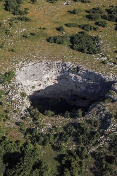
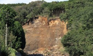
Sinkholes are dramatic because they happen fast. One moment, the pavement looks fine. Next, it drops into a hidden void. But these failures don’t appear out of nowhere. They start with small warning signs underground: leaking pipes, poorly compacted soil, or drainage that isn’t moving water away. Over time, water erodes the support system beneath the surface until the weight above is too much.
Bridgeport isn’t Bangkok, yet the same physics apply. Our region has clay soils that shrink and swell depending on moisture. Heavy rain can wash out fill dirt or push against retaining walls. Combine that with aging infrastructure, and you get conditions ripe for sudden collapses.
That’s where a topographic survey comes in. It turns invisible risks into visible data—before problems turn into emergencies.
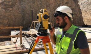
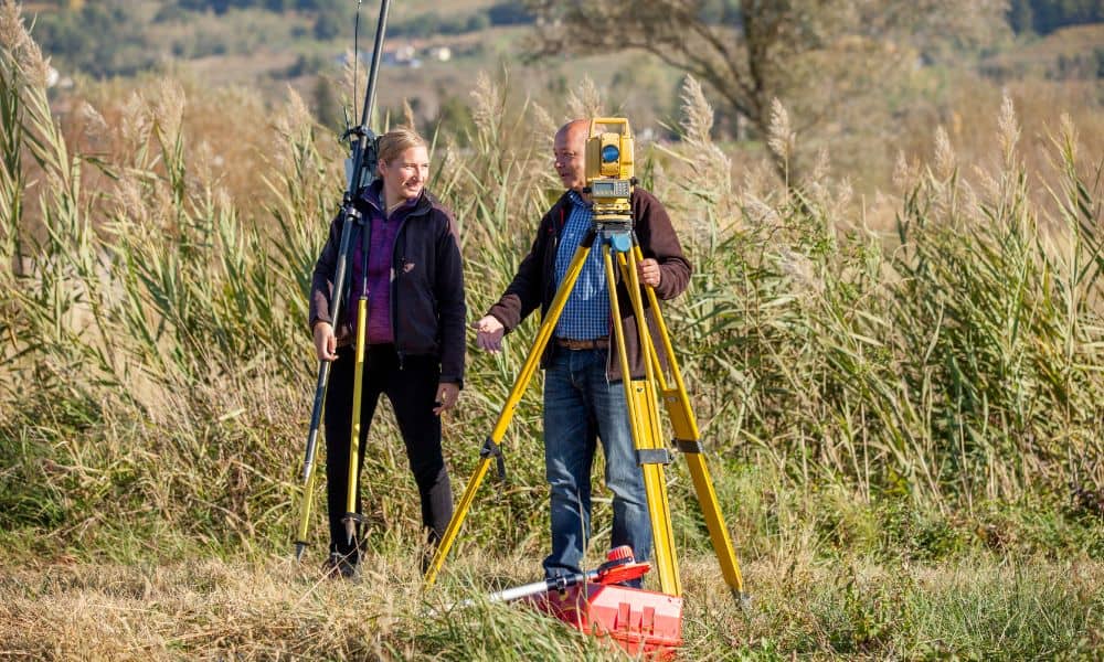
What a Topographic Survey Shows You
Think of a topographic survey as a detailed map of how land behaves. It doesn’t just draw lines on paper. It captures the lay of the ground, the flow of water, and the position of features like ditches, culverts, and utilities.
When a licensed land surveyor measures a site, they mark contours—lines that show elevation changes across the property. Even small differences, like half a foot, can reveal where water will pool after storms. Spot grades highlight exact elevations at key points: a driveway edge, a storm drain, or the base of a slope. These details help engineers design safe drainage systems and avoid low spots where water weakens the ground.
Utility mapping adds another layer. Old water or sewer lines may be leaking underground without anyone noticing. By marking their position and depth, a survey reduces the chance of future surprises.
In short, a topographic survey isn’t just a technical requirement. It’s a safety tool. It gives property owners and developers a clear picture of how their site interacts with water and soil.
Bridgeport’s Heavy Rain Problem
September storms showed how quickly rain can overwhelm Bridgeport. News outlets warned of flash floods in neighborhoods, on highways, and around commercial centers. For property owners, this is more than an inconvenience. Standing water seeps into foundations. Poorly drained lots can fail inspection. And in worst cases, too much water creates the underground voids that turn into sinkholes.
Here’s the reality: once a sinkhole opens, fixing it is expensive and disruptive. Repairs often require excavation, new backfill, and reinforced drainage. Insurance rarely covers the full cost, and property values take a hit.
By contrast, a survey costs far less and helps avoid these headaches. Having a current topo map means you know exactly where water flows and how the site responds during storms. For a growing city like Bridgeport, where new subdivisions, commercial sites, and infrastructure upgrades are common, this data is critical.
Lessons from the Viral Sinkhole
So what can learn from Bangkok’s viral sinkhole?
- Drainage is everything. When stormwater has no safe path, it finds its own—often underground.
- Utilities matter. Leaking pipes are a silent trigger for voids and collapses.
- Soil behavior is local. Clay-heavy soils hold water differently than sandy soils elsewhere. Knowing their limits is key.
- Regular updates save money. Conditions change. A topo survey from five years ago may not reflect current drainage patterns after heavy rains.
These lessons prove that a survey is more than paperwork for permits. It’s a proactive step toward protecting both people and property.
When Should You Schedule a New Survey?
Not every homeowner or developer knows when to call a surveyor. Here are moments that make sense:
- After major storms. If your yard or lot flooded recently, get elevations checked.
- Before new construction. Driveways, additions, or commercial builds need a solid foundation.
- When buying or selling property. Updated surveys give buyers confidence and help sellers avoid disputes.
- If you notice changes. Cracks, pooling water, or soft ground are all red flags.
The key idea: don’t wait for damage. Be proactive.
Making the Case to Property Owners
For residents, the viral sinkhole story is more than clickbait. It’s a reminder that land is dynamic and water is powerful. A topographic survey gives control back to property owners. It helps engineers design smart drainage, keeps builders compliant, and prevents the shock of sudden ground failure.
Whether you’re a homeowner protecting your yard or a developer planning a subdivision, the takeaway is the same: invest in knowing your land before nature tests it.
Conclusion
Bangkok’s sinkhole made global headlines, but Bridgeport has its own storm-related risks. Heavy rain, clay soils, and aging infrastructure set the stage for collapses if left unchecked. The smartest defense is a clear understanding of your site.
Topographic surveys deliver that clarity. They reveal how water moves, where soil may fail, and what needs attention before problems become disasters.
Viral news stories fade, but their lessons don’t. The next time the ground shakes up headlines, let it remind you: Sites can stay safe and stable—if you map the land before the rain tests it.