Land Surveying: Estimating the Cost

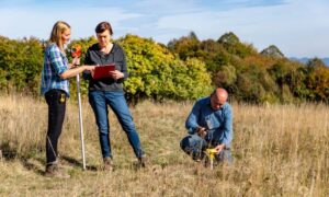
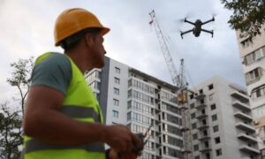
Land surveying, in short, is the science and art of establishing or re-establishing property corners, property lines and/or boundaries. There are different reasons why someone wants a lot surveyed.

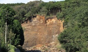
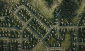
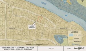
Essentially the most common is to check if a piece of land is vulnerable to flooding, to subdivide a property to sell or to determine if there are any encroachments. This may happen if a neighbor disputes that you are using a piece of his lot or vice versa (for more on this, go here).

The Cost of Land Surveying

If you need to have a piece of land surveyed, the first thing that will come to mind is “how much will it cost?”There are plenty of factors determining exactly how much land surveying for your land would cost.

The fact that this type of service must be carried out by an expert contributes a great deal to the overall cost of the service, but choosing a non-professional to survey your land is dangerous and possibly illegal for the non-professional. Because of this you have to take a good look around before settling with a surveying company.

If you must work within a particular budget, discuss this with the surveyor up-front. Very often he may be able to offer cost saving steps to get the work you need done within these cost limits. The form of the land must also be looked into. A square or even a rectangle piece of land is somewhat easier to survey than an odd shaped parcel, or one with many different sides.

With the latter, the surveyor would have to take more time in surveying the curves as well as the bends which means the cost of the service would go higher.

The overall measurements the land is also key factor here. Understand that the cost of land surveying is normally proportionate to the time and effort that the land surveyor would spend on the project. If the land that you’re having surveyed isn’t accessible, or has thick vegetation, then the total price of the survey might go higher.

This is true of the varying weather conditions that might impact the work. Surveying in warm weather is somewhat slower to keep from putting the crew members in danger. Also, most surveying can’t be done in the rain.

When requesting for an estimate, bear in mind that surveyors base the estimate on expected conditions at the site. These conditions could change, bringing about additional costs. Always ask about these potential additional cost scenarios.

All that being said, competitive prices are also to be expected, this is why we recommend deciding on a surveyor based upon his experience and reputation rather than on the price he writes on a piece of paper. Usually it is better to invest a good amount of money on a survey that’s well-done rather than choose a company with a very “affordable” price but have the survey repeated because the results were wrong.

To sum it up, you should always discuss the expenses of the survey before you decide to ask the surveyor to start his work. It’s also wise to receive a contract that lets you know what is expected of the land surveyor. This is one of the most important steps in getting your land surveyed.

More Posts

A steep hillside with exposed soil and erosion from a recent slope failure, showing the kind of hidden ground risks that drone surveying can reveal
land surveying
Surveyor

Can Drone Surveying Detect Hidden Ground Risks?

A few days ago, a landslide video from Italy went viral. Heavy rain hit a quiet hillside town, and within seconds, the ground gave way. A home collapsed and slid downhill like it was made of paper. People all over the world watched the clip in shock. As heartbreaking as

Read More »
Aerial view of a neighborhood with contour lines that resemble the elevation details shown in a topo survey
land surveying
Surveyor

What Lies Beneath Your Property? A Topo Survey Reveals It

When news about the Rolling Thunder Mine disaster spread across West Virginia, people stopped scrolling and paid attention. A crew hit an uncharted underground water pocket, the mine flooded in minutes, and rescue teams worked around the clock. The story felt far away from everyday life, yet it raised a

Read More »
Preliminary flood hazard map showing property location near a river and flood zones for elevation certificate assessment
flood damage
Surveyor

What to Screenshot Before You Order an Elevation Certificate

If you live in Bridgeport, West Virginia, and your bank or insurance company just asked for an elevation certificate, you’re probably wondering what it is—and why it costs money. Before you order one, there’s a simple way to save time and possibly avoid extra fees. You can use the free

Read More »
Land surveyors conducting a boundary survey in an open field under bright sunlight, checking instruments and marking property points
boundary surveying
Surveyor

Why Your Boundary Survey May Take Longer Than Usual

If you’ve ever scheduled a boundary survey and found out it’s taking longer than planned, you’re not alone. Lately, surveyors across the U.S.—including here in Bridgeport, West Virginia—have been facing rare delays caused by unexpected factors in the sky and in their equipment. The good news? These setbacks are temporary

Read More »
Drone land surveying at a construction site with a professional surveyor controlling the drone for mapping and site inspection
land surveying
Surveyor

New Drone Rules Every Drone Land Surveying Firm Must Know

If you work in drone land surveying, there’s big news you need to know. The state recently tightened its UAV privacy rule—changing how drones can legally fly over private property. This update doesn’t just affect hobbyists or photographers; it directly impacts how surveyors, developers, and property owners use drones for

Read More »
Concrete foundation with metal formwork and survey stakes from a construction staking survey at a quiet job site
land surveying
Surveyor

When a Construction Staking Survey Goes Wrong

When you start a new build or home addition, you expect things to go smoothly. The plans are ready, the permits are in, and you’ve hired a surveyor to mark where everything should go. But what happens when your construction staking survey goes wrong — or worse, your surveyor disappears

Read More »