If your lender or insurance company recently brought up flood zones, you are not alone. FEMA just updated many flood maps, and as a result, thousands of homeowners now face new flood rules. Because of these changes, people suddenly see higher insurance quotes, new paperwork requests, or delays during home sales. This is why one document now matters more than ever: the fema elevation certificate.
However, before you worry or assume the worst, it helps to understand what changed, why it affects your home, and how this certificate can protect both your money and your timeline.
Why Flood Zones Just Changed
Flood zones do not stay the same forever. FEMA updates flood maps often using better weather data, improved drainage studies, new building information, and modern measuring tools. Over time, cities grow, land shapes change, and storms become stronger. Because of this, old maps no longer show true flood risk.
Recently, FEMA released another round of flood map updates. These new maps changed flood boundaries and risk levels in many areas. As a result, some homes now fall into flood zones, while others move out.
Even if your property never flooded before, that does not mean the risk stayed the same. Instead, the science behind the maps improved, which caused flood lines to shift.
How Most Homeowners Find Out
Most homeowners do not hear about flood map changes directly from FEMA. Instead, they find out when something suddenly changes.
For example, your insurance renewal may arrive with a much higher price. Or your lender may pause your loan and ask for flood paperwork. In other cases, buyers and sellers discover the issue only days before closing, when paperwork suddenly stops moving forward.
At that point, confusion often sets in. Many people say, “Nothing changed at my house.” While that may feel true, the rules behind flood risk did change.
Because lenders and insurers must follow FEMA guidelines, they often ask for a fema elevation certificate to confirm the real flood risk of a property.
What Is a FEMA Elevation Certificate?
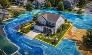
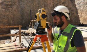
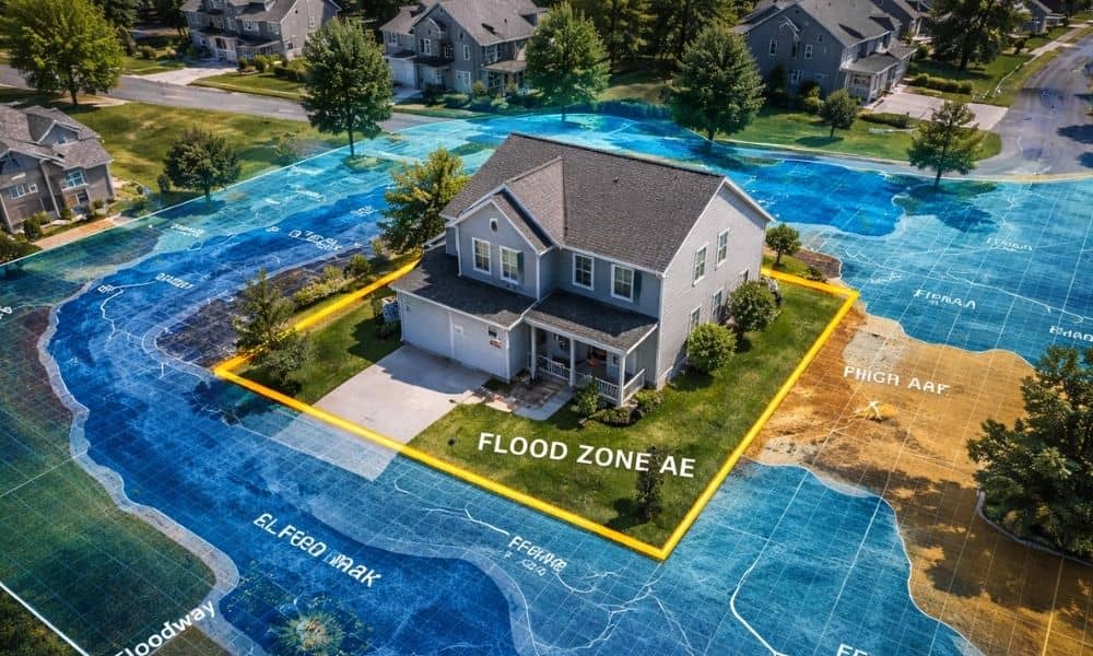
A FEMA elevation certificate shows how high your home or building sits compared to expected flood levels in your area. A licensed land surveyor visits your property, takes exact measurements, and fills out a FEMA form with those results.
Unlike online maps or property websites, this certificate gives real, accurate numbers. Lenders and insurance companies trust these measurements when deciding flood insurance rates and loan rules.
In simple terms, flood maps show a general area of risk, while an elevation certificate shows the exact truth about your home.
When Do You Actually Need One?
Not everyone needs a fema elevation certificate. However, some situations make it necessary.
You may need one if:
- Your lender asks for flood proof before approving your loan
- Your insurance company needs elevation data for pricing
- You plan to buy or sell a home in or near a flood zone
- You received notice that your flood zone changed
- Your flood insurance price suddenly increased
In these cases, the elevation certificate helps prove your real flood risk and protects you from paying more than needed.
Why Flood Maps Alone Can Be Confusing
Flood maps show wide areas and general risk levels. However, they cannot measure the exact height of your home. Because of this, many properties get placed into the same flood zone even when their heights differ.
For example, two homes may sit side by side. Both appear in the same flood zone on the map. Yet one home may sit two feet higher than the other. That small difference can decide whether flood insurance is required.
Because of this, flood maps alone often cause worry. A fema elevation certificate clears that confusion by showing true elevation.
How an Elevation Certificate Can Lower Insurance Costs
Flood insurance depends heavily on how high your home sits above flood levels. When surveyors confirm your home is higher than expected flood levels, insurance companies can lower premiums.
In many cases, homeowners save hundreds or even thousands of dollars over time. Some also remove flood insurance requirements completely when elevation results prove low risk.
Instead of guessing or paying high rates, an elevation certificate gives you solid proof.
Why Waiting Causes Closing Delays
Timing matters. Many buyers and sellers wait until lenders demand an elevation certificate. Unfortunately, this late timing often leads to rushed surveys, delayed closings, and high stress.
Survey scheduling, field measurements, and paperwork take time. When people wait too long, closing dates often move.
On the other hand, ordering an elevation certificate early keeps deals smooth. Buyers feel confident, sellers avoid problems, and lenders move faster.
Common Mistakes Homeowners Make
After flood zones change, homeowners often make simple mistakes that cost money.
These mistakes include:
- Paying higher insurance without checking elevation
- Trusting online maps as exact
- Using old certificates
- Waiting until the last minute
Avoiding these mistakes saves time, money, and stress.
What Happens During an Elevation Survey?
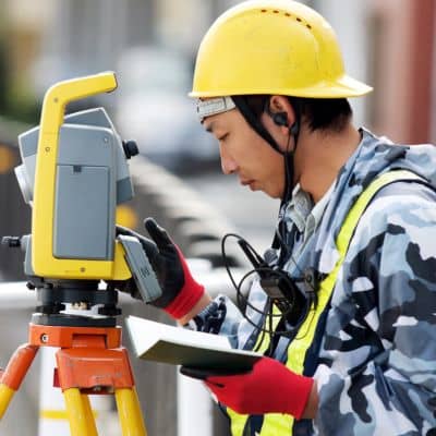
A licensed land surveyor visits your property and takes careful height measurements using professional tools. They record building levels, ground heights, and reference points.
Next, the surveyor completes FEMA’s official form. This certified document then goes to your lender or insurance company as proof.
The process stays quick, clean, and simple. Most surveys take little time and do not disturb your daily routine.
Why Flood Zone Updates Matter More Than Ever
As weather patterns change and cities grow, flood risks will continue to shift. Because of this, flood maps will keep updating. This means elevation certificates will play a bigger role in future home ownership.
Instead of reacting after problems start, smart homeowners stay ahead by confirming their elevation early.
Final Thoughts
Flood zone changes can feel scary and confusing. However, a fema elevation certificate brings clarity and peace of mind.
If your insurance cost changed or your loan stalled, the best first step is confirming your real elevation. With the right data, you avoid overpaying, prevent delays, and protect your investment.
In today’s changing flood environment, knowing your true flood risk helps you stay in control.