Buying or building a home is exciting, but it also comes with questions you might not expect. One of those is whether you need a flood elevation survey. If you live in Bridgeport, this is more than just paperwork. It can affect your insurance costs, your building permits, and even your peace of mind.
What Is a Flood Elevation Survey?
A flood elevation survey measures how high your home or property sits compared to the official Base Flood Elevation (BFE). The BFE is the height floodwaters are expected to reach during a “100-year flood” event. Surveyors collect measurements of your structure, including the lowest floor, foundation, and critical utilities. The results are documented on FEMA’s Elevation Certificate, which becomes a legal record.
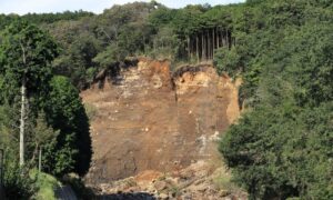
In plain terms, it shows whether your property is at risk if the creek next to your lot overflows or if heavy rains overwhelm the drainage system. For homeowners near Brushy Fork or Simpson Creek, this document is especially important.
Why It Matters in Bridgeport
Bridgeport continues to grow, with new subdivisions and commercial areas. That growth means more homes and businesses are being built near creeks, storm drains, and other low-lying areas. The city requires proof that new construction in a floodplain is safe. Flood elevation surveys are often the only way homeowners can prove compliance.
It also matters for insurance. Mortgage lenders and the National Flood Insurance Program (NFIP) rely on this data to set premiums. Without it, you might be stuck paying higher rates—or worse, face delays in closing on a loan.
For homeowners already living, a survey can sometimes lower existing insurance costs if it shows your home sits above the risk line. That’s money saved every year.
How to Know If Your Property Is in a Flood Zone
The first step is checking the West Virginia Flood Tool online. This interactive map lets you type in your address and see whether your parcel falls inside a Special Flood Hazard Area (SFHA). If the map shows your property in or near a shaded flood zone, you’ll likely need a survey.
Even if your house looks far from water, don’t assume you’re safe. Many properties near small creeks or drainage basins still fall within flood hazard boundaries. That’s why a visual check isn’t enough—relying on official data matters.
When You Need a Flood Elevation Survey
There are several common situations where a flood elevation survey is required:
- Building a new home or addition in a mapped flood zone.
- Applying for permits for major renovations or substantial improvements.
- Buying a property in a flood-prone area where the lender demands documentation.
- Renewing or adjusting insurance when premiums seem too high.
Think of it this way: if your project touches the ground and you’re anywhere near water, the city or your insurer will probably want proof.
How the Process Works
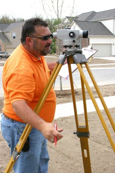
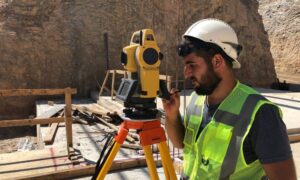
A licensed land surveyor visits your property to take precise elevation shots. They measure the ground, your foundation, and key structural points. These are compared against FEMA’s published BFE for your location.
The surveyor then completes the FEMA Elevation Certificate, which includes diagrams, elevation numbers, and photos of the property. Once finished, you can use this document to:
- Submit with your permit application at City Hall.
- Provide to your mortgage lender during closing.
- Send it to your insurance company to prove your risk level.
It’s technical work, but for the homeowner, it’s as simple as hiring a surveyor and getting the report.
Local Rules You Should Know
Bridgeport follows a flood damage prevention ordinance. This ordinance sets the rules for construction inside flood hazard areas, including the minimum elevation requirements for new homes. If your property doesn’t meet those standards, the city can deny your permit.
The Floodplain Administrator also handles appeals and map changes, such as Letters of Map Amendment (LOMAs). If you think FEMA’s maps show your property incorrectly, a flood elevation survey is often the first step in proving it.
Having a survey in hand gives you options. Without it, you’re stuck with the default assumption that your property is at risk.
Benefits Beyond Compliance
Many homeowners see flood elevation surveys as just another hurdle. But the benefits go further than compliance:
- Lower insurance premiums: If your home is above the BFE, you may save hundreds of dollars every year.
- Faster loan approvals: Lenders move quicker when required paperwork is already complete.
- Peace of mind: Knowing your property’s exact status reduces stress during heavy rainstorms.
- Resale value: Buyers prefer homes with clear documentation, especially in areas where flood risk is a question.
Think of it as an investment in both safety and financial stability.
Homeowners’ Next Steps
If you’re unsure whether you need a flood elevation survey, start simple:
- Check the Flood Tool for your address.
- Call the Permits & Zoning office to ask if a survey or Elevation Certificate is already on file.
- If not, contact a licensed land surveyor to schedule the survey.
From there, the surveyor handles the measurements, the paperwork, and provides the certificate you need.
Final Thoughts
A flood elevation survey might not be the first thing on your mind when you think about your dream home. But in Bridgeport, it’s often the key to unlocking permits, lowering insurance, and protecting your investment.
Don’t wait until a lender or the city surprises you with the requirement. Take the proactive step now. It could save you time, stress, and money down the line.