When news about the Rolling Thunder Mine disaster spread across West Virginia, people stopped scrolling and paid attention. A crew hit an uncharted underground water pocket, the mine flooded in minutes, and rescue teams worked around the clock. The story felt far away from everyday life, yet it raised a question many homeowners don’t ask: What’s really under my property? This is where a topo survey becomes more important than most people realize.
The mine incident was a tough reminder that the ground can hide surprises. Old tunnels, forgotten shafts, natural voids, and shifting underground water can shape the land even if nothing looks wrong on the surface. Homes, yards, and new construction projects depend on stable ground, so understanding how land behaves is a smart move for anyone living in Bridgeport.
WV’s History Lives Under Our Feet
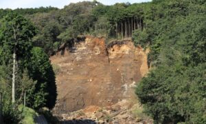
West Virginia’s past isn’t just in museums. It’s beneath the soil, inside hillsides, and scattered across old mining corridors. Many mines shut down decades ago, and their tunnels were left empty. Over time, these spaces weakened, shifted, or filled with water. Some collapsed. Others stayed open and unnoticed.
Even if your Bridgeport home isn’t near an active mining area, the land can still carry older layers of activity—cut-and-fill areas, buried trenches, previous grading work, or natural underground pockets. These features don’t make noise or leave signs right away. They change slowly. The Rolling Thunder story simply reminded the public that the earth doesn’t always follow the patterns we expect.
Why Bridgeport Should Pay Attention
Bridgeport continues to grow. New subdivisions, hillside homes, and commercial projects reshape the landscape every year. Builders level lots, move soil, and tie new streets into older areas. With every improvement, the land changes a bit more.
Because of that, even stable neighborhoods may sit on ground that behaved differently decades ago. Some lots were flattened long before crews used modern compaction standards. Others have underground utilities placed before accurate mapping existed. Meanwhile, natural voids and underground channels can shift over time, especially in hilly regions.
These conditions don’t create sinkholes out of nowhere, but they can cause slow, steady movement—often too subtle to catch with the naked eye. A small dip in the yard, a deck that leans a little, or soil that settles unevenly may point to changes happening below the surface.
This is where a topo survey can help you understand what’s going on before problems grow.
How a Topo Survey Spots Surface Clues Connected to the Underground
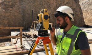
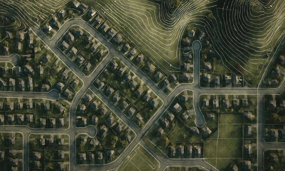
A topo survey is more than a map with lines. It shows the exact shape of your land by measuring elevations across your property. The surveyor collects dozens or even hundreds of points on the ground. These points tell a story about how the land rises, falls, or shifts.
Small changes matter. For example:
- A low spot forming during a dry season
- A slope that becomes steeper over a few years
- A yard that develops a slight tilt
- A ridge that wasn’t noticeable before
These shifts don’t always point to weather or drainage. Sometimes they reveal slow settlement from old fill dirt. Other times they show movement linked to underground voids or forgotten man-made features. When a topo survey shows patterns, homeowners can see issues early rather than deal with big repairs later.
This type of survey also helps people who want to start a project. If you’re planning an addition, garage, or deck, knowing how the land sits gives your contractor a safe starting point. Builders rely on accurate elevations to make sure structures won’t be stressed by shifting ground.
Tools Surveyors Use to Understand Ground Behavior
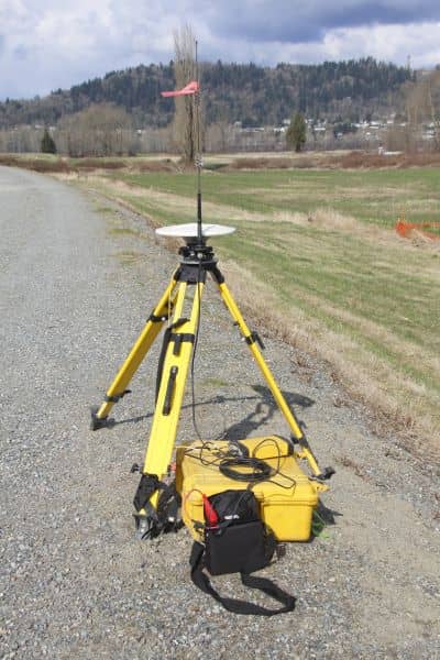
Surveying today is more advanced than it used to be. Professionals use several tools to study land that might sit above older mining activity.
Historic mine maps. These show where tunnels and shafts were once located. Even if a house isn’t directly above one, nearby activity can still influence soil behavior.
LiDAR elevation data. LiDAR is a powerful technology that uses lasers to create super-detailed models of the earth’s surface. It reveals tiny changes in the land that people could never notice on their own.
GIS mapping layers. GIS datasets store information about old utility corridors, grading work, and past land disturbances. They help surveyors understand how the land changed over time.
Comparing old topo data with new results. If older survey records exist, comparing them with a fresh topo survey can reveal long-term movement. A difference of even a few inches can say a lot about what’s happening beneath the ground.
With these tools, surveyors don’t guess. They study patterns, connect the dots, and show homeowners what the land is doing today compared to the past.
Everyday Signs Homeowners Miss
Many people look for dramatic warning signs, but underground movement usually starts small. Because the shifts are slow, homeowners write them off as normal aging. Here are subtle changes that sometimes match deeper ground movement:
- A section of the yard dips even during long dry periods
- A patio slab that leans more each year
- Soil settling in one corner of a lot instead of across the whole yard
- A fence that becomes uneven without any storm damage
- A deck that feels slightly off-balance
These signs don’t confirm a problem, but they do tell you the land is changing. A topo survey helps you understand how and why.
When Getting a Topo Survey Makes Sense
You don’t need a topo survey every year. But you should consider one when something changes above ground—or when you’re about to change something yourself.
Here are smart times to schedule one:
Before buying property. You want to know exactly how the land is shaped and whether it shows signs of movement.
Before expanding your home. Additions, garages, and decks need solid land. Elevations help you build safely.
Before new construction on older lots. Past grading or buried features can affect today’s work.
If nearby properties had heavy excavation or new construction. The ground can shift when crews dig or move soil close to your property.
If you notice slow changes over several months or years. These small shifts often reveal patterns a topo survey can document clearly.
The Mine Disaster Was a Wake-Up Call
The Rolling Thunder flooding wasn’t just a mining incident. It was a reminder that the ground holds secrets. Some are harmless. Others matter to homeowners, especially in a growing place like Bridgeport.
Topo surveys give you a clear view of your land today. They show whether the surface is stable, shifting, or acting in ways that deserve attention. They also bring peace of mind when you’re planning improvements, selling property, or protecting your investment.
Underground surprises don’t always make headlines, but they can still affect your home. With the right information, you can make smart decisions long before small changes turn into big problems.