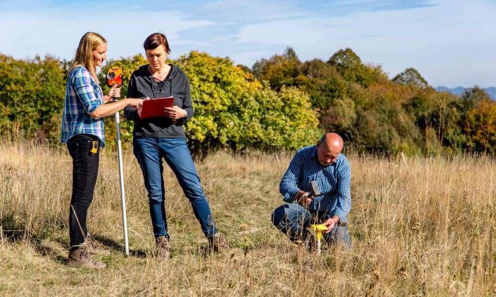
If you’ve ever scheduled a boundary survey and found out it’s taking longer than planned, you’re not alone. Lately, surveyors across the U.S.—including here in Bridgeport, West Virginia—have been facing rare delays caused by unexpected factors in the sky and in their equipment. The good news? These setbacks are temporary and are often a sign that your land surveyor is doing the right thing by protecting accuracy rather than rushing your results.
When the Sun Gets in the Way
Most of us don’t think about the sun when we think about land surveying. But in the last few days, solar weather—yes, actual storms on the sun—has been causing problems for survey crews across the country.
Here’s how it works: the sun releases charged particles that interact with Earth’s atmosphere, creating what’s called ionospheric activity. Those waves can distort the satellite signals surveyors use to pinpoint locations. Even a small disturbance can make a GPS receiver think a corner is a few inches—or even a few feet—off.
On Reddit, surveyors have been posting screenshots of their rovers stuck in “float mode,” unable to lock onto a fixed position. NOAA’s Space Weather Prediction Center even issued a G1–G2 geomagnetic storm alert for October 28–30, meaning signal interference was expected worldwide.
For a homeowner, that might sound like a minor tech glitch. But in surveying, every fraction of an inch matters. So, when solar storms hit, experienced surveyors don’t push through—they pause, verify, and recheck. It’s the only way to keep your boundary survey legally defensible and 100% accurate.
How Solar Glitches Affect Fieldwork
A professional surveyor doesn’t lose data during a solar storm, but they might collect it more slowly. Instead of finishing your boundary corners in one visit, they may return on a clearer day or double up on verification shots.
You might notice they’re spending more time “standing still” with the equipment. That’s not downtime—it’s precision work. They’re logging raw GNSS (satellite) data, waiting for the signal to stabilize, or using total stations as a backup.
Think of it like taking a photograph. If the light flickers, you wait for the right exposure instead of snapping a blurry picture. That’s exactly how surveyors handle ionospheric noise—by waiting for the perfect reading rather than rushing and risking a bad result.
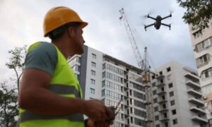
The Drone Problem No One Expected
While the skies were busy throwing solar storms at surveyors, another challenge hit the ground—equipment downtime. Specifically, drones.
Many modern boundary and topographic surveys now use drones to capture aerial imagery and establish control points. In late October, the U.S. Federal Communications Commission (FCC) renewed its scrutiny of DJI, the most popular brand of survey drones. That sparked confusion online and in surveying communities about which models could be used and whether firmware updates might ground existing fleets.
Even if a firm’s drone is still fully compliant, responsible surveyors test every update before flying it on a client’s property. If an update causes camera calibration or flight control issues, it could delay your project by a few days.
It’s not just a technical hassle—it’s a quality decision. Reputable surveyors don’t want to risk inaccurate aerial data or missing photo documentation. When they hold back a flight, it’s because they’re ensuring your survey’s images and coordinates line up perfectly with the ground control points they’ve measured.
Bridgeport’s Growing Pains
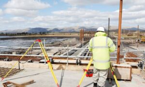
Bridgeport isn’t a flat city. It has rolling hills, wooded lots, and new subdivisions developing along the I-79 corridor. Surveyors here rely on both ground-based and aerial methods to get clear, accurate data. When solar storms or drone firmware issues pop up, those hybrid workflows naturally slow down.
If your project involves a larger lot or sits near heavy tree cover, your surveyor might need a mix of satellite, drone, and total-station methods to verify every boundary corner. A short delay now can prevent costly disputes or rework later.
How Professionals Keep Accuracy on Track

The best surveyors plan ahead for these challenges. They don’t just react—they prepare. Here’s what’s happening behind the scenes while you’re waiting for results:
- They monitor NOAA’s solar-weather dashboards daily and schedule fieldwork during quieter conditions.
- They log raw GNSS data so it can be reprocessed once the ionospheric noise clears.
- If drones are down for maintenance or regulatory review, they switch to traditional ground methods.
- They double-check their control points before finalizing your plat or report.
Each of these steps ensures that your boundary lines aren’t just “close enough”—they’re precise to the inch.
What You Can Ask Your Land Surveyor
When your project hits a small delay, you don’t have to stay in the dark. Asking a few smart questions can help you understand what’s happening and build trust with your surveyor.
Try asking:
- “Are you waiting for clearer satellite conditions?”
- “Do you log backup GNSS data if there’s interference?”
- “Do you have a non-drone option if flights get delayed?”
- “How do you make sure the data stays consistent if the equipment pauses mid-survey?”
These questions show that you care about accuracy—and they’ll remind you that your surveyor is protecting your investment, not wasting your time.
Tools You Can Check Yourself
If you’re curious about what’s affecting your project, here are a few reliable public tools:
- NOAA Space Weather Prediction Center – for live solar-storm alerts.
- DJI Newsroom – for firmware and regulation updates.
- Reddit’s r/Surveying community – to see what professionals are experiencing in real time.
They’re great resources for understanding that sometimes, the delay isn’t your surveyor—it’s the planet.
The Bottom Line:
Delays can be frustrating, especially when you’re eager to start construction, settle a property line, or close on a home. But in surveying, speed is never worth sacrificing precision.
When solar storms scramble satellites or drones face unexpected downtime, the surveyors who slow down are the ones who care most about doing the job right. They’d rather check, verify, and deliver a report that holds up in court than rush a map that creates a dispute later.
So, if your boundary surveys took an extra day or two this week, take it as a good sign. It means your surveyors are adapting to the same forces that guide airplanes, GPS systems, and satellites—and ensuring your property lines stay solid no matter what the sun, or the latest firmware update, decides to do.