Most people saw the news this week about the brilliant Northern Lights stretching across the United States. Photos of glowing skies went viral on social media. But behind the beauty of this solar storm is a less glamorous fact: it can disrupt GPS signals. And for anyone who needs an ALTA Land Title Survey, those signals matter more than you might realize.
An ALTA Land Title Survey is more than just a property map. It is the industry standard survey required by lenders, title companies, and attorneys in commercial real estate deals. It confirms boundary lines, identifies improvements, shows easements and rights-of-way, and notes potential risks that could affect ownership. Because accuracy is critical in an ALTA Land Title Survey, even a slight GPS error caused by a solar storm can ripple into delays, disputes, and extra costs.
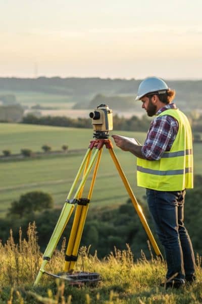
The Role of GPS in an ALTA Land Title Survey
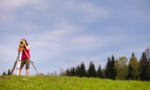
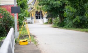
Modern surveyors rely heavily on GPS, or more precisely GNSS (Global Navigation Satellite Systems), to set control points, measure boundaries, and map improvements. This makes fieldwork more efficient and precise—most of the time.
Why does this matter to you as a client? Because an ALTA Land Title Survey must meet strict standards. If the measurements are off even by a foot, it can create serious problems. A fence might appear outside the true boundary, or a structure could look like it encroaches onto a neighbor’s lot. For a bank or title company reviewing your closing documents, that small error is a big red flag.
How Solar Storms Disrupt GPS Signals
Solar storms, like the one that just lit up the skies, release charged particles that disturb Earth’s atmosphere. While we enjoy the Northern Lights, surveyors deal with interference in the ionosphere—the layer that GPS signals must travel through.
For an ALTA Land Title Survey, this interference can translate into “drift.” A GPS reading might place a corner point feet away from its actual location. In agriculture, drift can send tractors off their rows. In surveying, drift can create boundary errors that ripple through the entire survey map.
For property owners, lenders, and developers, this means risk. If your ALTA Land Title Survey is wrong, it can delay a loan closing, stall a construction project, or even spark legal disputes over property lines.
Real-World Risks for Your ALTA Land Title Survey
When GPS signals are unstable, surveyors deal with the technical challenge, but clients face the real-world consequences. Here’s how it impacts you:
- Loan delays: A title company or lender won’t accept an ALTA Land Title Survey that doesn’t line up with the deed. That can push your deal back.
- Costly construction mistakes: If staking is off, crews may build in the wrong place. Fixing it later costs far more.
- Boundary disputes: An inaccurate corner can lead to neighbor conflicts and even lawsuits.
- Flood and insurance issues: ALTA Land Title Surveys often include FEMA flood information. If misaligned, it could raise insurance requirements.
The short version: a solar storm might seem like a sky show, but if it disrupts GPS, it can quickly affect your project here on the ground.
How We Keep Your ALTA Land Title Survey Accurate
The good news: professional surveyors don’t depend on GPS alone. Even during space weather, there are proven ways to protect the accuracy of an ALTA Land Title Survey.
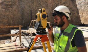
- Double-checking with total stations: These use angles and distances from fixed points, providing a reliable backup to GPS.
- Redundant observations: We take multiple measurements and compare results. If one looks off, it doesn’t make it into the final survey.
- Scheduling smartly: Storm activity often peaks at night, so we time critical observations during more stable periods.
- Transparent reporting: A licensed surveyor will note conditions in the report, so you and your lender know the data is reliable.
This layered approach ensures that your ALTA Land Title Survey still meets national standards—even when the sky is unpredictable.
Why This Matters in Bridgeport
Bridgeport and Harrison County continue to see steady growth in both housing and commercial projects. In every transaction, from refinancing to development, the ALTA Land Title Survey is the key document that lenders and attorneys use to move a deal forward.
That’s why accuracy matters so much here. While social media might be buzzing about the aurora, your surveyor’s priority is making sure your loan, your build, or your property purchase isn’t delayed by the same solar storm.
What Clients Should Do
You don’t need to study space weather to protect your investment. What you do need is a licensed surveyor who understands both the science of GPS and the strict requirements of an ALTA Land Title Survey.
When ordering your survey, ask:
- How do you handle GPS disruptions?
- Do you cross-check results with total stations?
- Can you confirm that my ALTA Land Title Survey will meet lender requirements even during unusual conditions?
A qualified surveyor will have confident answers to those questions—and that confidence is what keeps your project safe.
Final Thoughts
Solar storms may light up the sky, but they don’t have to create problems for your property deal. While GPS drift is a real challenge, careful planning and experience keep your results reliable. An ALTA Land Title Survey is one of the most important steps in protecting your investment, and it deserves the highest level of accuracy.